
Emergency Operations Committee issues wildfire updates

By Emergency Operations Centre

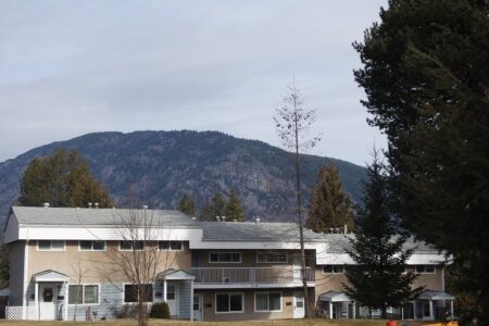
THERE ARE NO EVACUATION ALERTS FOR GRAND FORKS OR CHRISTINA LAKE AT THIS TIME
Wildfire Update for August 24:
There will be a Rock Creek fire residents meeting on Monday August 24 from 7 to 9 p.m.
If you were impacted by the recent wildfires, please attend this meeting to find out what services are available to you. For more information, visit www.RDKB.com
Lynch Creek:
•This fire is located 25km north of Grand Forks and is approximately 200 ha and 10 per cent contained.
•The BC Fire Service is working on containment of the east flank of this fire.
•Smoke from this fire is visible to the residents of the North Fork area. BC Wildfire Service Lynch Creek Fire Information Page http://bcwildfire.ca/hprScripts/WildfireNews/OneFire.asp?ID=579
Stickpin Fire:
•The BC Fire Service is monitoring the winds that are impacting the direction of the fire.
The fire is approximately 19,240 ha and 15 per cent contained.
•Significant resources are being mobilized to Christina Lake in preparation should the winds push the fire to the northeast
.•On Sunday August 23rd, 33 BC Wildfire Service Firefighters and three Officers began fire suppression activities on the Stickpin Wildfire in North Ferry County, Washington. They are responsible for Branch 3, also known as the Canadian Branch, on the Northeast potion of the fire. Objectives included developing situational and operational awareness for the first days on the fire, identifying fire lines, and determining strategies and tactics moving forward.
•In the event that the BC Wildfire Service provides air support to this fire, it is likely Christina Lake would be used as a water source for amphibious skimmer aircraft. Boaters can help with suppression efforts by immediately proceeding to the nearest shore if they see a plane approaching the water.A spotter plane sounding an alarm will signal the approach of air tankers.
Rock Creek Fire:
•The fire is approximately 4,534 haand is 75per cent contained.
•Ministry of Agriculture is working with farmers to restore internet services so supplies can be ordered for livestock.
•Smokey conditions may be expected in the Midway, Greenwood and Rock Creek areas. Much of the smoke is originating from fires in the United States. To see a smoke forecast for western Canada, visit finforhttp://www.bcairquality.ca/bluesky/west/index.html
•This area contains multiple potential hazards, including active wildfire, “danger trees” (trees whose root systems have been weakened by fire activity), heavy equipment use and downed power lines.
•Entering any restricted area can delay firefighting activities, contribute to the growth of the fire and possibly put more values and people at risk. Safe fire suppression efforts depend on the support and understanding of the public. The Resiliencycentre remains open in Midway at:692 7Ave, Midway,250.449.2310. Wildfire Service Rock Creek Fire Information Page: http://bcwildfire.ca/hprScripts/WildfireNews/OneFire.asp?ID=569
PaulsonFire
•The Paulson fire is currently 300ha and is 80 per cent contained.
•Crews are continuing to mop-up on the western and north flanks.
•This fire is highly visible from HWY 3. The Highway was closed briefly last night, however, it is now open to single lane alternating traffic with the assistance of a pilot car. Limited Visibility with Smoke from Eholt Summit to Paulson Bridge.
BC Wildfire Service Paulson Fire Information Page: http://bcwildfire.ca/hprScripts/WildfireNews/OneFire.asp?ID=576
Big Sheep Creek Fire
•The Big Sheep fire is approximately 190ha and is 60 per cent contained.
•The south and west flanks are contained and today crews will focus on the enforcement of control lines.
•A public access restriction is in effect for the areas around the Big Sheep Creek wildfire west of Rossland. This restriction takes effect immediately and remains in force until the public is otherwise notified.
•Public access restriction is in effect for the areas around the Big Sheep Creekwildfire west of Rossland. This restriction takes effect immediately and remains in force until the public is otherwise notified. This restriction is being put in place to protect the safety of the public and firefighting personnel and closes the Seven Summits trail at the intersection of Red Resort to the intersection at the Old Cascade Highway. The Seven Summits trail remains open from the Nancy Greene Summit to Red Mountain Resort. BC Wildfire Service Big Sheep Creek Fire Information Page http://bcwildfire.ca/hprScripts/WildfireNews/OneFire.asp?ID=578
Important Links
•http://bcwildfire.ca/hprScripts/WildfireNews/FireCentrePage.asp
•EmergencyInfoBC:Online source for emergency alerts about natural disasters and provider of public education and preparedness information.
•DriveBC:Road conditions and closures
•BC Air Quality:The Air Quality Health Index is a health protection tool that is designed to help you make decisions to protect your health by limiting short-term exposure to air pollution and adjusting your activity levels during increased levels of air pollution.
•Interior Health: During a forest fire, be aware of health risks associated with exposure to smoke, food safetyin power outages, and water quality.
Travel:
Highway 33 is now open. Travel from Rock Creek to Kelowna is now possible along this highway
. From Rock Creek to Beaverdell there is a 60km/h speed limit in effect. Please watch for work crews and livestock. Drivers be advised that Rock Creek to Westbridge is still an active fire area and crews are patrolling for fire activity. The BC Fire Service is aware of smoke and hot spots. Please do not report these incidences to keep phone lines open for emergencies.
Please remember to drive safely. Be aware of service and flagging crews and fire crews that are working on our roadsides
.


Comments