
Area restriction reduced for Bill Nye Mountain fire

By Southeast Fire Centre
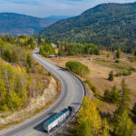
The BC Wildfire Service continues to respond to the Bill Nye Mountain (N11629) fire that originated seven kilometres southeast of Wasa.
The recent downturn in weather has bolstered weeks of hard work by firefighters, heavy equipment, and aerial resources. As a result of these efforts combined with the more favourable weather conditions over the last few days, fire activity has been reduced.
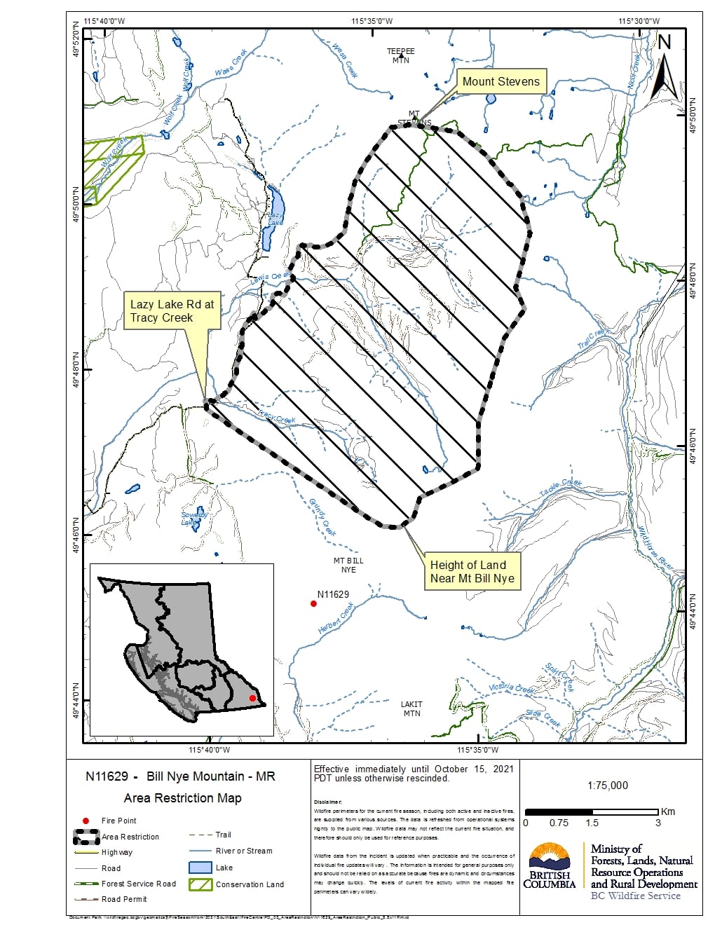
Effective immediately the area restriction in the Bill Nye Mountain area will be reduced in size. While the size has been reduced, there is still a continued need to protect the public in areas where ongoing fire suppression activities are taking place.
This reduced area restriction is now in effect and will remain in effect until 12 p.m. (PDT) on Oct. 15, 2021, or until rescinded. The order applies to Crown land within the geographic boundaries described below and outlined in the correlated map:
- Commencing at Tracy creek, off the Lazy Lake rd.
- Straight line East South-East between Tracy creek and Grundy creek to the height of land North East of Bill Nye Mountain.
- Continuing north along the height of land towards Hughes peak to Mount Stevens, then descending south along the ridge east of Lazy lake to tie into Lewis creek road.
- Following Lewis Creek Rd to Lazy Lake Road, along Lazy Lake Road back to point of commencement.
- Note: Travel Lewis Creek FSR is prohibited.
- Note: Lazy Lake Road and Lazy Lake Rec site are no longer included in the Area Restriction.
Under this Order and section 11(2) of the Wildfire Act, a person must not remain in or enter the restricted area, unless the person:
- first receives written authorization of an official designated for the purposes of the Wildfire Act, or
-
enters the area only in the course of:
- travelling to or from his or her residence, that is not under an evacuation order;
- travelling to or from private or leased property for the purpose of accessing a secondary or recreational property, that is not under an evacuation order;
- using a highway as defined in the Transportation Act;
- travelling as a person acting in an official capacity as defined in s.56 of the Wildfire Act; or
- travelling for the purpose of supporting wildfire suppression or enforcement patrol activities.
A detailed map of the affected area is available: http://ow.ly/kkTr50FT0mR
Failure to comply with Section 11 restricted area requirements may result in a violation ticket of $1,150.
Road closures and area restrictions are subject to change depending on fire activity. For the most current information please visit the bans and restrictions section of the BC Wildfire website for the Southeast Fire Centre, or visit: http://ow.ly/k5jT50Fvlk3
The Southeast Fire Centre extends from the U.S. border in the south to Mica Dam in the north, and from the Okanagan Highlands and Monashee Mountains in the west, to the B.C.-Alberta border in the east.
To report a wildfire call 1 800 663-5555 toll-free or *5555 on a cellphone. For the latest information on current wildfire activity and burning restrictions visit: http://www.bcwildfire.ca or download the BC Wildfire App free for Apple and Android devices.


Comments