Dry conditions turn up the heat in the forest
The dog days of summer and dry temperatures have turned up the heat on the fire risk in the area.
A province-wide caution over fire use has been issued — including campfires — as forest moisture is drying up in the relentless heat of late summer.
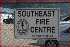
The fire danger rating in the Southeast Fire Centre is currently “moderate” to “high” with pockets of “extreme” in the Boundary, Arrow and Kootenay Lake fire zones, with the forest near Nelson still hovering at a moderate fire risk.
But the dry conditions are beginning to cause some problems close to home — including a lightning storm Tuesday night in the Southeast Fire Centre, within the Arrow Fire Zone and Kootenay Lake Fire Zone.
Many of these fires are highly visible in the area, but none of them is currently threatening any structures or communities.
- Three separate fires are burning about 12 kilometres south of Boswell in the Sanca area, east of Kootenay Lake. These fires are all 0.5 hectares or smaller. Airtankers, a helicopter and initial attack crews are working on site.
- Initial attack crews are responding to two small wildfires about five kilometres north of Queens Bay in the Coffee Creek region, west of Kootenay Lake.
- Twenty-five BC Wildfire Service personnel are responding to a 0.2- hectare fire south of Champion Lakes Provincial Park, a 0.4-hectare fire on Mount Heinze (east of Birchbank) and a 0.5-hectare wildfire on Keystone Mountain (northwest of Salmo).
- A 0.7-hectare wildfire west of Slocan Park in the Waverton Creek area is in steep, difficult terrain. A helicopter and initial attack crew are en route.
Last week two B.C. Wildfire Service initial attack crews assisted the Balfour Harrop Volunteer Fire Department with a .2-hectare fire on the North Shore.
“This fire is now 100 per cent contained,” the Southeast Fire Centre’s fire information officer, Karlie Shaughnessy, noted.
The wildfire at the end of Rogers Road on the North Shore was caused by a tree falling on the main transmission lines running along the North Shore, easily igniting in the dry forest floor, the Regional District of Central Kootenay reported late last week.
Given the marked increase in wildfire activity in the Okanagan Valley and elsewhere in the province over the past week, caution is now urged with any fire use.
The B.C. Wildfire Service is currently responding to a number of fires in the Southeast Fire Centre that are visible from surrounding communities. None of these fires is immediately threatening communities or structures, said Shaughnessy.
The wildfire west of Trout Lake (in the Wilkie Creek area) covers about 30 hectares and is being closely monitored. This fire is burning in very steep terrain, so it is unsafe for ground crews to access it directly.
Other major fires burning in the area include a lightning-caused wildfire burning on Curry Mountain (northeast of Beaverdell) but is now 100 per cent contained and is in the “patrol” stage.
The smoke from a 60-hectare wildfire burning in Granby Provincial Park has drifted and is now visible in the region, including Nelson, the Slocan Valley, the Lower Arrow Lake region and Castlegar.
Due to the potential ecological benefits of this fire and its remote location, the B.C. Wildfire Service and B.C. Parks are only monitoring this fire and not actively suppressing it.
“Fire is a natural process and helps maintain a healthy forest and a diversity of plant and animal life,” said Shaughnessy.
Allowing naturally occurring fires to burn in remote areas of Granby Provincial Park is consistent with B.C. Parks’ Fire Management Plan. The fire has grown by 20 hectares in the last week.
Updates regarding the recreational use of the park are posted on the B.C. Parks website.
As well, several wildfires in Washington state, particularly one near Deep Lake in Stevens County, are sending smoke north to the Kootenay region.
The Deep Lake wildfire is 15 kilometres south of the border and covers about 300 hectares. The B.C. Wildfire Service is providing airtankers to help suppress this fire.
Since April 1, 139 wildfires have burned 174 hectares in the Southeast Fire Centre.
Of those fires, 51 were caused by lightning and the rest were caused by people.
New Porto Rico Bridge coming to Ymir
The construction of a new single-lane bridge is underway south of Nelson near the village of Ymir.
This new bridge will replace the aging Porto Rico Bridge near Ymir, The Porto Rico Bridge is a single span structure that was built in 1923 and upgraded in 1967.
The $699,315 contract has been awarded to M. Johnston Construction Ltd. and is expected to be completed by mid-November.
The Porto Rico Bridge replacement project is located on Porto Rico-Ymir Road, just north of Ymir. The road will be closed to through traffic during the project and people should adjust their plans accordingly by using an alternate route.
















Comments