
Sand, sandbags available for residents in Westbridge, Beaverdell, Rock Creek

By RDKB
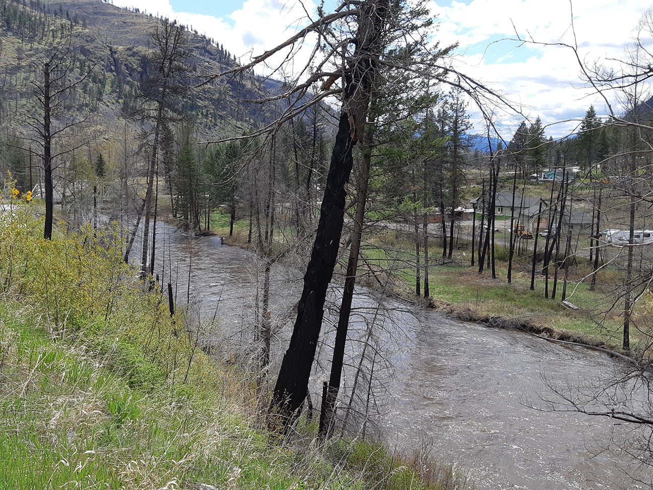
The Regional District of Kootenay Boundary wants residents in Westbridge, Beaverdell and Rock Creek to prepare for higher water levels in tributaries to the West Kettle River and possible flooding at low elevations.
On the afternoon of May 12, Environment Canada issued a Special Weather Statement for southern B.C. with five to upward of 30 millimetres of rain forecast to fall unpredictably across the region for the next one to two days.
“We have identified the West Kettle system as a place to watch right now because we know from past storms this year that this drainage reacts to rainfall in the headwaters at Big White and at higher elevations above Christian Valley,” said Mark Stephens, Emergency Operations Centre Director for the RDKB.
“Residents of all these West Boundary communities are going to see higher flows and we want anyone who is in those really low-lying areas to have access to sand and sandbags as we head into the weekend.”
Residents in the Westbridge, Beaverdell and Rock Creek areas can pick up sandbags and sand free of charge at the following locations:
- Beaverdell behind the Fire Hall
- Westbridge Hall
- Rock Creek Community Hub
Residents must bring their own tools and equipment (shovels, transportation) and respect a physical distance of two metres (six feet) between workers as they fill sandbags.
Stephens said emergency officials are also watching the main-stem Kettle River, but that it is slower to respond to brief rainfall events, and has more capacity overall.
The RDKB could add a fourth sand pickup site in the Grand Forks area targeting only catalogued residences that typically flood in moderate flow years, and will make that decision based on forecasts early on May 13.
The RDKB is monitoring all rivers and creeks in the region and will update the response based on forecasts in the next 12 to 24 hours and update the public accordingly.
Current BC River Forecast Centre models show that rivers will reach seasonal peaks in the Boundary within the next seven to ten days, depending upon weather.
“We can reassure Boundary residents that we don’t have the snowpack we had in 2018,” said Stephens.
“With these sandbag sites open now, we want to be sure that residents have time to prepare for some possible flooding while maintaining physical distance from others. They may or may not see an actual need for those sandbags. Where and how much rain falls will determine that.”
Residents in the West Boundary who are most at risk of flooding should stay informed about local freshet conditions, and ensure they have considered plans for moving valuable items, livestock or other items to safe locations if required. The RDKB also asks everyone to stay well away from the edges of creeks and rivers as banks become unstable during high water.
For more information about how to safely sandbag during the COVID-19 pandemic, visit: https://www2.gov.bc.ca/gov/content/safety/emergency-preparedness-response-recovery/emergency-response-and-recovery/flood-response
For more information about snow and river levels as well as how to prepare for the 2020 freshet, visit emergency.rdkb.com.
To register for the RDKB Emergency Alerting System got to https://ca.voyent-alert.com/vras/user-registration.html.
The RDKB will continue to update the public as new information is available.


Comments