
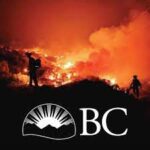
Smoke from wildfires south of the border once again tosses blanket over province

By Nelson Daily Staff
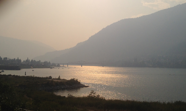
The BC Wildfire Service said majority of the thick smoke blanketing many areas of southern B.C., is drifting northward from large wildfires in the United States.
“The smoke arrived in British Columbia yesterday (Saturday) evening due to strong southerly winds,” the media release said.
“A temperature inversion trapped the smoke in the valley bottoms which has resulted in poor visibility and air quality issues.”
The smoke prompted Environment Canada to issue a smoke advisory for the enitre Okanagan Valley, north and South Thompson, Nicola, Shuswap and southern areas of the Boundary and Kootenay regions.
Southerly winds have been widely spreading heavy plumes of smoke northwards from the large wildfires burning in Washington state, resulting in high concentrations of fine particulates and poor air quality.
The smoke pushed north through BC and into northern Alberta Sunday and can be seen on the smoke forecast for western Canada.
Some of the cause for the smoke is from the Stickpin fire, located 4.5 kilometers south of the U.S/Canada border near Grand Forks and Christina Lake.
This fire grew rapidly on Thursday, Aug 13 and Friday, Aug 14 due to strong southerly winds, low humidity and high temperatures.
However, has been minimal growth on this fire Saturday and most of the growth has been to the east.
There are no evacuation alerts or orders associated with this fire for residents north of the border in Grand Forks and Christina Lake.
The Southeast Fire Centre said Sunday public access restriction for areas around the Big Sheep Creek wildfire west of Rossland will take effect immediately and remain in force until the public is otherwise notified.
The closure is due to 190-hectare Big Sheep Creek wildfire, which is 30% contained and highly visible from the city of Rossland.
Currently, 33 personnel, five helicopters and two pieces of equipment are on-site.
This restriction is being put in place to protect the safety of the public and firefighting personnel and closes the Seven Summits trail at the intersection of Red Resort to the intersection at the Old Cascade Highway.
The Seven Summits trail remains open from the Nancy Greene Summit to Red Mountain Resort.
Detecting new fires in this situation can be challenging. If you spot open flame from a new wildfire or a distinct column of smoke, please report it to *5555 or 1-800-663-5555 as soon as possible.
The wildfire smoke is expected to remain for the next few days.
To see the current smoke forecast for western Canada, visit http://firesmoke.ca/
For the latest information about air quality, check http://www.bcairquality.ca/
For more information about forest fires and your health, visit Interior Health’s website: https://www.interiorhealth.ca/YourEnvironment/EmergencyPreparedness/Pages/Forest-Fires.aspx
For up-to-date information on current wildfire activity or burning restrictions visit: www.bcwildfire.ca


Comments