RDKB issues two evacuation alerts in City of Grand Forks due to erosion
The Regional District of Kootenay Boundary Emergency Operations Centre (EOC) issued two more evacuation alerts on May 27 bringing the total number of properties on evacuation alert in the Grand Forks area to sixteen.
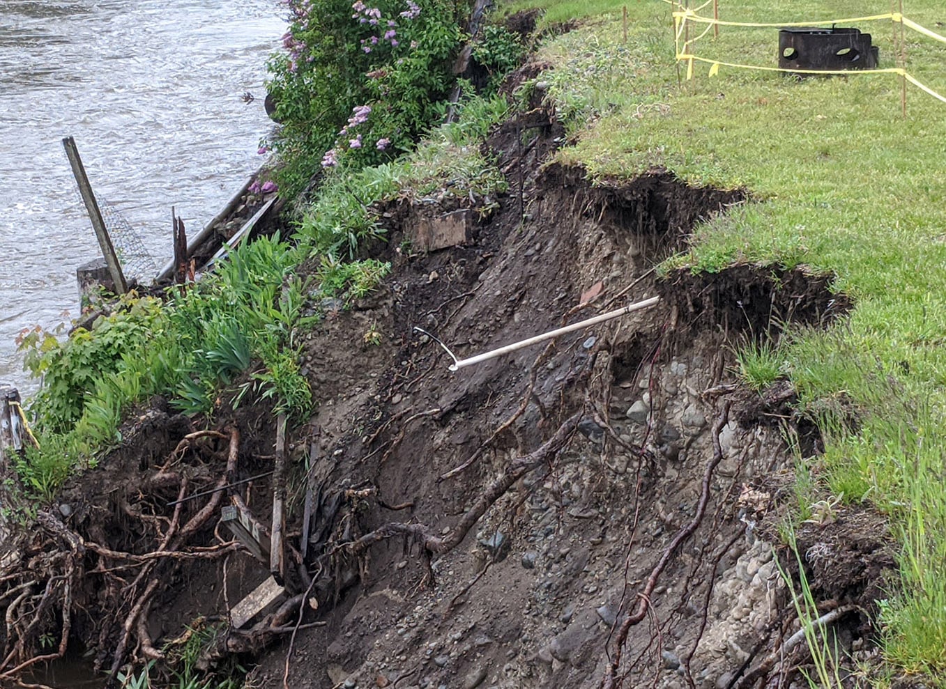
The latest two properties alerted are on 19th Street north of 61st Street along the Kettle River in the City of Grand Forks. The riverbank eroded considerably in 2018 making the site vulnerable to further erosion during high water this spring. Following an assessment by geotechnical engineers, the RDKB has been advised to ask residents to prepare to leave the area with very short notice should conditions worsen and require alerts to become orders.
In addition to the 19th Street properties, seven properties in Manly Meadows and seven properties in Johnson Flats also remain on evacuation alert due to risk of flooding.
“It’s a really stressful time for everyone who has been alerted right now, especially given that we have more snow to melt in the mountains. Our main focus is keeping residents safe and making sure we are clear about the forecasts we receive and how those could affect anyone along the Kettle River System including these two properties in the City of Grand Forks,” said Mark Stephens, EOC Director.
Current river forecasts show the Kettle River remaining at typical freshet level until May 29, then potentially rising to higher flood levels late this weekend, or early next week, depending upon rainfall amounts and locations. Temperatures are forecast to reach the low thirties on May 29 and 30 – up to twelve degrees above seasonal – and rain and thunderstorms are possible over the weekend but still far from certain.
The RDKB continues to monitor all creeks and rivers in the Boundary and reviews all BC River Forecast Centre models including those that currently show a large spike in river levels the week of June 1. The RDKB will keep residents informed of the potential accuracy of that forecast once higher confidence information is available near the end of this week.
The EOC is currently at a Level 2 and will ramp up to a Level 3 if flood risks increase this weekend. The City of Grand Forks and the RDKB are also working together on operational pre-planning for flood protection of major infrastructure if required.
The High Streamflow Advisory issued by BC River Forecast Centre on May 6 remains in effect for the Boundary Region including the Kettle River, West Kettle River, Granby River and tributaries, and could be upgraded to a Flood Watch or a Flood Warning if weather conditions dictate that closer to the weekend or through the weekend.
Sandbags and sand are currently available for residents in the following locations free of charge:
- Beaverdell behind the Fire Hall
- Westbridge Hall
- Riverside Centre in Rock Creek
- Grand Forks Arena
Residents must bring their own tools and equipment (shovels, transportation) and respect a physical distance of two metres (six feet) between workers as they fill sandbags.
Residents in the Boundary who are most at risk of flooding should stay informed about local freshet conditions, and ensure they have considered plans for moving valuable items, livestock or other items to safe locations if required.
For more information about snow and river levels as well as how to prepare for the 2020 freshet, visit emergency.rdkb.com.
To register for the RDKB Emergency Alerting System go to https://ca.voyent-alert.com/vras/user-registration.html. The RDKB warns everyone to stay away from the edges of watercourses and report any erosion or flooding to the Provincial Emergency Coordination Centre at 1-800-663-3456.
The RDKB is aware of will continue to update the public as new information is available.











Comments