UPDATED: Environment Canada ends Severe Thunderstorm Watch
Environment Canada ended its Severe Thunderstorm Watch as of Thursday afternoon for most of the Southern Interior.
However, regions can still expect the risk of thunderstorms and snow at higher elevations as an unsettled weather pattern continues to grip the region.
As for people travelling highways in the province, spring weather can make conditions in B.C. unpredictable, particularly through high mountain passes.
The public should be prepared and be aware that winter tires and chains may still be needed.
Please check the Souther Interior Flood Recovery-Travel Advisories link on the DriveBC website.
Environment Canada ends Severe Thunderstorm Watch
Environment Canada is continuing its Severe Thunderstorm Watch as of Thursday afternoon for the West Kootenay, Kootenay Lake, Arrow-Slocan, East Kootenay, Boundary and Okanagan as a cold front continues to sweep across the Southern Interior.
“A cold front will sweep eastwards across the Okanagan early this evening then through the Kootenay region later in the evening, triggering the potential for the development of severe thunderstorms,” the Environment Canada website said.
“The main threat from these storms is heavy downpours, hail and strong wind gusts.”
“Environment Canada has upgraded its storm alert to a Severe Thunderstorm Watch Thursday morning,” the website added.
Environment Canada said 10 to 20 mm of rain is likely over many regions by Friday morning with the potential for higher amounts in regions affected by severe thunderstorms.
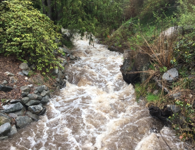
“This weather situation combined with spring snow melt will lead to rising river levels and may increase the risk of flooding.
“Quickly flowing water and the adjacent river banks are potentially unsafe. Don’t approach washouts near rivers, creeks and culverts, and keep away from creek and river banks.”
For people who need sandbags, the Regional District of Central Kootenay has posted a web link to the respective locations.
The River Forecast Centre issues stream flow advisories and warnings when necessary to provide alerts to potential flood conditions in the stream systems of the province.
Please refer to the River Forecast Centre website for updated stream flow advisories or warnings.
Severe Thunderstorm Watch for Boundary, Arrow, Slocan and West Kootenay regions
Environment Canada said on its website that conditions are favourable for the development of severe thunderstorms that may be capable of producing strong wind gusts, large hail and heavy rain.
“A strong and moist flow of air coming up from the northwestern US prevails over the B.C. southern interior this morning. A coastal cold front will sweep across the mountains and into the interior this afternoon, triggering the potential for the development of severe thunderstorms.
“The main threat from these storms is heavy downpours and powerful wind gusts.”
Environment Canada is forecasting 15 to 25 mm of rain is likely over many regions by Friday morning with the potential for higher amounts in regions affected by severe thunderstorms.
The Severe Thunderstorm Watch is in effect for Okanagan, Boundary, Arrow, Slocan and West Kootenay regions.
Thunderstorm watches may be extended eastwards later today.
The public is warned that lightning can kill and injures Canadians every year.
“Remember, when thunder roars, go indoors!”
For people who need sandbags, the Regional District of Central Kootenay has posted a web link to the respective locations.
Special Weather Statement issued for West Kootenay
Environment Canada has issued a Special Weather Statement for the West Kootenay region as rain embedded thunderstorms is expected to begin Thursday over the Southern Interior.
The Weather Statement has prompted the Regional District of Central Kootenay to issue a warning to residents to be aware of the possibility of rising lake and river levels which could result in flooding due to the heavy precipitation.
“A developing cold front will stall over the Southern BC Interior late Thursday and begin to transition out of the area on Friday,” said Environment Canada.
“Rain and the threat of thunderstorms are likely beginning Thursday.
“This weather situation combined with spring snow melt will lead to rising river levels and may increase the risk of flooding.”
Environment Canada, forecasting between 10-20 mm of precipitation, said quickly flowing water and the adjacent riverbanks are potentially unsafe.
“Don’t approach washouts near rivers, creeks and culverts and keep away from creek and river banks.”
The River Forecast Centre issues streamflow advisories and warnings when necessary to provide alerts to potential flood conditions in the stream systems of the province.
Please refer to the River Forecast Centre website for updated streamflow advisories or warnings.
Residents requiring sandbags can contact the Emergency Program Coordinator in their area:
Nelson / Kaslo & Areas D, E, F, I, J — 250-352-8177
Nakusp / Slocan & Areas H, K — 250-265-0230
Creston & Areas A, B, C / Salmo & Area G — 250-428-0299
To report flooding or landslide, residents can call the 24/7 Provincial Emergency Reporting Number at 1-800-663-3456.
IN CASE OF EMERGENCY – DIAL 911
CLICK HERE for information on debris flow hazards.
CLICK HERE for information on Flood Protection and Planning.
CLICK HERE for Kootenay Lake water levels.
Residents are urged to please sign up for the FREE Emergency Notification System.


Comments